Recognized as America’s longest river, the Missouri River is known as the “Center of Life” in the Great Plains. From agriculture to food, this winding waterway plays a major role for those who live close to the river and plays a historic, important economic part in the building of America and opening of the western frontier. Where Does the Missouri River Start and End?
The Missouri River a tributary of the Mississippi starts in Three Forks, Montana, as the confluence of 3 major rivers, Madison, Jefferson & Gallatin & ends in St. Louis, Missouri. Crossing South Dakota, North Dakota, Nebraska, Iowa, Colorado, and Kansas, & at 2,540 mi. is the longest river in the US.
The Missouri River long ago garnered the nickname the “Big Muddy,” inspired by the enormous loads of sediment it pushed through the river system.
Introduction:
Understanding the beginnings and ends of natural landmarks provides deeper insight into the history of America. This article sheds light on a waterway that has played a significant role in America’s history: the Missouri River.
This powerful and extensive river originates and concludes within the continental boundaries of the United States, stretching across multiple states. Specifically, we’ll be exploring the river’s path through the breathtaking landscapes of Montana, unraveling the mystery of where the Missouri River truly starts and ends. Join us on this journey as we follow the Missouri River’s course, from humble beginnings to its triumphant end.
Where Does the Missouri River Start
The Missouri River, an essential part of Montana’s geography as well as the United States at large, boasts an intriguing history and a significant role in navigation. Indeed, ‘Where does the Missouri River start and end?’ is a query that unveils a fascinating exploration of geography and history in the Northern part of the U.S. The Missouri River begins its course from Brower Spring in Montana, considered the river’s source, making it the longest river in North America.
From this upper source hidden among the great landscapes of Montana, the Missouri River starts its over 2,300-mile journey across the states. Covering great distances, the symbolic river serves as an essential source of water for the land it traverses, fostering growth across the Great Plains. The river’s journey, layered with history, traces from where the Missouri River begins and meanders south to the city of Omaha.
Starting from Brower Spring, nestled in Montana’s captivating terrain, the river charges ahead, for hundreds of miles, creating a narrow path through this upper state. As it begins to mark its course, history illustrates that this river played an integral role in navigation, as the waterway became an instrumental aspect in settling the west, its springs serving as essential sources of life.
The Missouri River, overland, continues its voyage, crossing multiple states, and eventually leading to its destination in Nebraska. This river, with its starting point in Montana, flows through the likes of Kansas, contributing to the land’s fertility, before arriving in Nebraska. The Missouri River’s endpoint, a sight that is a testament to the river’s journey over thousands of miles, is a testament to the unyielding resilience of nature.
These rivers, including the Missouri River, throughout their extensive journey, not only impact the land but also foster a diverse species population due to the various climate conditions along the path. Floods may occur as well, showcasing the raw and unpredictable nature of these rivers. However, the Missouri River, despite these disruptions, remains a vital source of life and navigation, from its beginning at Brower Spring in Montana to its convergence with the Mississippi.
Considered the “Center of Life” for the Great Plains, Missouri has served as the main artery for exploration, food, trade, and transportation for millions of people over thousands of years. About one-fourth of all the agricultural land in the U.S. is found in the Missouri River watershed, which provides more than one-third of the country’s wheat, flax, barley, and oats. Its significance to American culture past and future cannot be overstated.
Missouri River History
In 1673, Father Jacques Marquette and explorer Louis Joliet traveled down the Mississippi River. When they reached another river that came from the northwest, Father Marquette noted on his map that a large tribe of native people called the Missouri tribe meaning” people with big canoes” people who lived upstream called the river Ouemessourita.
A misconception of the naming of the river and the state of Missouri comes from Father Jacques Marquette calling the river “Pekitanoui” meaning “muddy,” in May 1673. In actuality, the river and the state were named after the Siouan Indian tribe whose Illinois name, Ouemessourita, means “those who have dugout canoes”.
The mighty river that flowed into the Mississippi eventually was named after the tribe that lived along its banks. It became the Missouri River. Later, when settlers came, the area became known as the Missouri Territory, and in 1821 when the territory became a state, it adopted the name Missouri.
In early 1803 the US began negotiations with the French government to buy the Port of New Orleans but ended up with all of the lands between the Mississippi and the Missouri River’s headwaters, in what is known as the Louisiana Purchase. This huge amount of land included 828,800 square miles and opened up our country to the expansion that would take place to the American West.
 Under President Thomas Jefferson an amount of $2,500 was allotted to a small US Army unit to take the trip to explore the Western frontier to the West Coast and the Pacific Ocean.
Thomas Jefferson personally selected 28-year-old Army captain, Meriwether Lewis to lead the expedition, afterward known as the Corps of Discovery. Lewis, in turn, selected a former Army comrade, 32-year-old William Clark, to be co-leader of the Expedition.
On May 14, 1803, Lewis and Clark left St. Louis, Missouri with 45 men, a 55-foot keelboat, and two large canoes making their way up the Missouri River to its headwaters for the first time.
They were able in a few short months reach the headwaters of the Missouri River, at the confluence of the Jefferson, Madison, and Gallatin Rivers on July 28, 1805. Meriwether Lewis would document the entire trip by keeping a daily journal.
The 3 streams that make up the headwaters of the Missouri River were named by Lewis and Clark after the President of the United States and the Secretaries of the Treasury and state.
Where Does the Missouri River End
The Missouri River, garnering quite a reputation as the longest river in the United States, has a journey before it meets its end. This grand river starts its flow at the Missouri Headwaters State Park, where three great springs unite to give birth to this majestic Missouri water body. It’s a 2,341-mile stretch loaded with significance; it traverses through different states, shaping the geographies it touches and becoming a key element in the nation’s history.

Well, it’s interesting to note that after the river Missouri and the great journey through the upper sections of the United States, Missouri gracefully takes a bow and ends its journey by merging with another legendary river, the mighty Mississippi. This union takes place in St. Louis, Missouri, a fact that makes it all the more intriguing.
After the upper stretches of the landscape painted with the beautiful National Parks of Montana, the Missouri River flows downstream, subtly changing the lay of the land, until it reaches its grand ending in the state of Missouri.
This ending isn’t just about a river journey; it’s the culmination of an awe-inspiring voyage that crosses states, witnesses numerous ecological changes, and profoundly impacts both the land and its fauna. The Upper Mississippi River, in turn, flows into the Lower Mississippi and eventually empties into the Gulf of Mexico, etching a fascinating network of United States rivers.
Stretching its watery tendrils across Montana, North Dakota, South Dakota, Nebraska, Iowa, and Kansas, the Missouri touches corners of these states before finding its conclusion. It’s an invaluable resource, supporting the ecology of these states. Owing to river Missouri and its significance, each state it flows through takes great responsibility for preserving its ecological balance.
In Iowa and Kansas, the Missouri plays a pivotal role in defining the landscape. Iowan and Kansan lands are bountiful, thanks to the waters of the Missouri. It’s as if the river rights itself a veritable path of life as the river meanders through these states before its ending.
Therefore, the ending of the Missouri River is ensconced in the embrace of the Mississippi River, forming part of a complex water network that’s undeniably essential to the United States. It’s imperative to recognize the significance of this water body, its journey, and the way it weaves through the states. While we know where the Missouri ends here it’s hardly an ending – it’s more of a merging, a fruitful union of two great rivers that shape our great nation.
*If you have ever flown over St. Louis in a Flight the view of these 2 mighty rivers meeting under the arches is a masterpiece of a view from the sky.
Exploring the Longest River’s Journey from the Missouri Headwaters in Montana to the Mississippi River
Discover the journey of the Missouri, the longest river nestled in the Great Plains of Montana’s wilderness in the United States. This mighty river, also known for its fantastic fishing opportunities and plentiful fish species, stretches for miles, beginning at its source, the Missouri Headwaters. This place is not just a state park but also a historical trail followed by many pioneers in the early days of America’s westward expansion.

Montana, a state widely recognized for its stunning landscape, featuring majestic upper lakes and mesmerizing wildlife, is the proud starting point of the River. Embarking on its journey from Missouri Headwaters State Park in Three Forks, Montana, where three upper branches of the Missouri River namely, the Gallatin, Madison, and Jefferson Rivers merge, forming the longest river in the United States, the Missouri River.
Moving eastwards, this river traverses through multiple states, including Iowa and Nebraska, carrying its waters across the Great Plains. Along the course of the river, you’ll find numerous dams contributing to its flow, feeding lakes as it snakes its way across state lines.
The serene wildlife that lines the course of the river presents a haven for the public who enjoy nature’s unspoiled beauty from the river’s banks. Fishing enthusiasts throng the state park’s banks in pursuit of a great day of fishing, often boasting of the large numbers and the size of the fish they catch.
The journey of this river does not end in Montana. The Missouri River continues its voyage, flowing into the Mississippi River after winding its way through miles and miles of diverse terrain. When considering all its tributaries and the Mississippi, into which it drains, the Missouri-Mississippi combo is regarded as the fourth longest river globally.
Interestingly, there are often debates among geographers about exactly where the Missouri River ends. It essentially merges with the Mississippi at St. Louis, Missouri. By the time the water reaches the Mississippi, it has traveled a great distance starting from the headwaters of the Missouri River in Montana. Thereby, making the Missouri River an essential part of the navigational waterways of North America.
Conclusively, it takes several days to explore and fully appreciate the magnitude of the Missouri River. Also, it’s important to note that though the river begins in Montana, it impacts many other states along its course before finally merging with the Mississippi River. Missouri River’s reputation as the longest river in the United States will undoubtedly continue to draw adventurers, anglers, and rafters alike to marvel at this testament to the country’s natural beauty.
Dams on the Missouri River
The Missouri River, one of the longest rivers in the United States, has several dams along its course. The exact number of dams can change over time due to construction, removal, or modifications. As of my last knowledge update in January 2022, there were multiple dams on the Missouri River. Some of the major dams include:
- Fort Peck Dam in Montana
- Garrison Dam in North Dakota
- Oahe Dam in South Dakota
- Big Bend Dam in South Dakota
- Fort Randall Dam in South Dakota
- Gavins Point Dam in Nebraska
There are other smaller dams, diversions, and structures along the river as well. The Missouri River provides water for many cities and communities along its course, including major metropolitan areas like Kansas City, Omaha, and St. Louis. It also supplies water for agricultural and industrial purposes.
The Missouri River and Pollution
The Missouri River, like many large rivers, faces various pollution challenges. The extent of pollution can vary along different sections of the river, and it can change over time due to a variety of factors, including industrial and agricultural runoff, wastewater discharge, and other human activities.
Some common sources of pollution in the Missouri River include:
- Agricultural Runoff: The river passes through significant agricultural areas, and runoff from farms can introduce nutrients and pesticides into the water.
- Wastewater and Industrial Discharges: Municipal and industrial wastewater can introduce pollutants into the river, including chemicals, heavy metals, and organic contaminants.
- Sedimentation: Erosion from construction, agriculture, and deforestation can lead to increased sediment in the river, which can affect water quality.
- Trash and Debris: Trash and debris can accumulate in the river, impacting water quality and aquatic habitats.
- Nutrient Pollution: Excess nutrients like nitrogen and phosphorus can lead to issues like algal blooms and low oxygen levels in the water.
Efforts are made to monitor and address these pollution issues. Federal, state, and local agencies, as well as various environmental organizations, work to improve water quality and protect the Missouri River ecosystem. Water quality standards and regulations are in place to limit and reduce pollution, and there are ongoing efforts to restore and maintain the health of the river.
The specific state of pollution in the Missouri River can vary depending on the location and current environmental conditions. Regular monitoring and collaborative efforts are essential to address and mitigate pollution concerns.
Uncovering the Path of the Missouri River
So where exactly does the Missouri River start and end? The answer lies in the Riverside state of Montana, or more specifically, the upper Missouri area. In this, the Northern United States’ longest river has its humble beginnings. The river journey spans thousands of miles, ending ultimately in the mighty Mississippi River, demonstrating the full scope of the river’s impressive journey.
.jpg&ehk=v3jMWc4%2fR4OIgHBaMQPQRfECyH5XmfFK9NADoPgGhpE%3d&risl=&pid=ImgRaw&r=0)
The river’s name, said to be derived from the Native Algonquin term for people of big canoes, certainly does the Missouri River justice. Flowing from its source in Montana’s Rocky Mountains across a spectrum of North American landscapes, this river is a symbol of the Great Plain’s natural beauty. With a length exceeding 2,341 miles, it’s clear why Missouri is often referred to as the “River of the Great Plains”.
Far from a simple stream, the river’s course reveals a grand spread across the United States. Originating from an area known as the Missouri Headwaters State Park in Montana, it courses through the Great Plains and the upper Missouri region, the river meandering southwards through several states including North and South Dakota and Nebraska, before flowing into the Mississippi.
The journey of this river, day in and day out, has shaped and continues to shape the lands of the United States. Its flow has carved natural borders for states and provided a source of sustenance to countless native species and human communities. On a clear day, you can watch the Missouri lay a course through the Great Plains, a site as awe-inspiring as it is symbolic of America’s natural heritage.
Yet, the story of where the Missouri River starts and ends is still not entirely told. While its main source is in the Montana Rockies and it concludes in St. Louis, Missouri, the path of the river entails an intricate network of tributaries and distributaries that have won it the title of the longest river in North America.
From North Dakota’s glacial plains, through the fields of South Dakota, and the lush farms of Nebraska, each state through which this river passes attests to its influence and power. If you visit this river, its natural history will show itself, its strength as a resource will assure itself, and its important role in the United States will proclaim itself. Any map will show you the river, but only a journey down its path will let you uncover the Missouri River.
From Upper Missouri through North Dakota and Various States
The Missouri River starts at the great Upper Missouri in Montana, where lake waters that spring from the mountains trickle to form the river’s headwaters. A journey along the river is quite a lengthy trip, seeing as it’s the longest river in the United States. The initial stretch which is the Upper Missouri, is famed for a great display of history, with fossil species imprinted on rock surfaces. The river’s beginnings testify to the rich, natural history of the land.
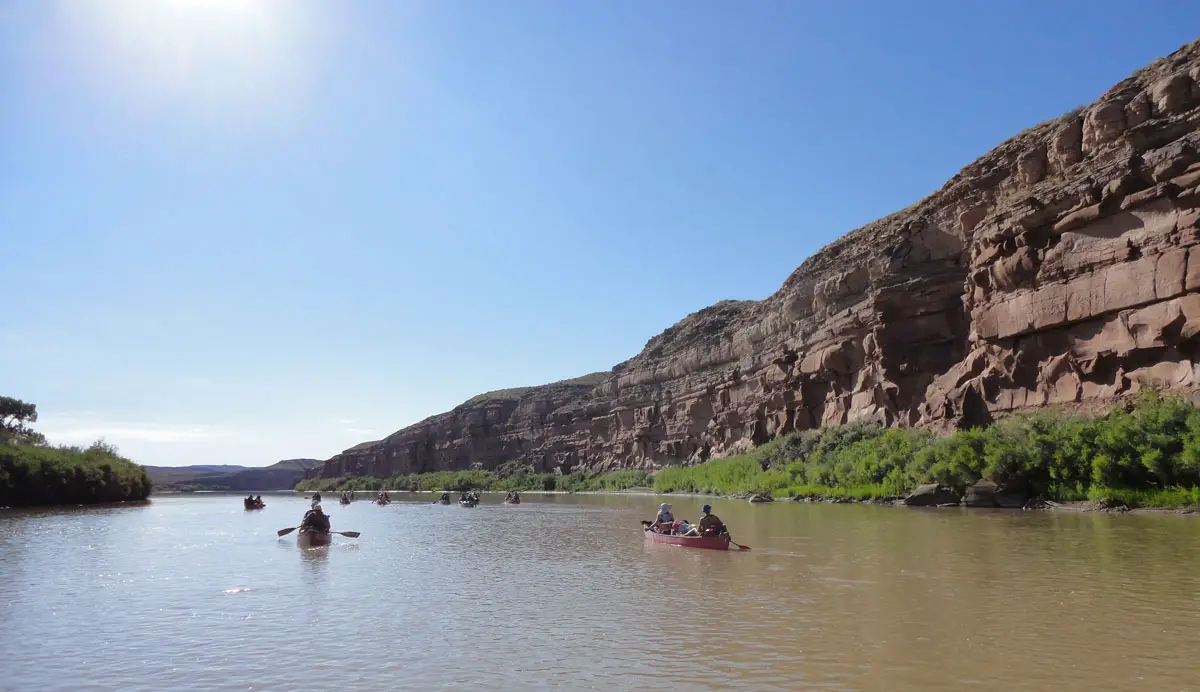
From the Upper Missouri, the river winds its way, day by day, through North Dakota and South Dakota. In these states, the river is a lifeline for many species of fish, offering a thriving ecosystem for various types of life. The riparian zones of North Dakota and South Dakota provide several recreational opportunities like fishing and boat touring. The dams situated in these states also contribute substantially to electricity production, a testament to how the Missouri River powers not just life, but industry too.
As it charters its course, the Missouri River continues through Nebraska and onward to several other states. Along these miles of waterway, there’s a wealth of national parks that attract visitors from around the world. These parks encapsulate the spirit of the great American landscape in their vast, breathtaking wilderness.
They are a testament to the nation’s commitment to conservation, providing a sanctuary for species and a treat for nature lovers. Flood management is, of course, a necessity for such a massive river course. The dams along the Missouri River play a significant role in protecting the land from the devastating effects of floodwaters.
Despite the river and its beautiful flow and vast expense that sparks a sense of adventure, one can’t help but wonder about the river and its end. Indeed, where does the Missouri? After miles and miles of traversing through various states and under countless bridges, the river Missouri and its journey culminates as it meets the Mississippi River.
This culmination is highly symbolic. Two great rivers of the United States unite, reflecting the unity and diversity that characterize the country. The Missouri River, from its beginning at a modest spring-fed lake in the heart of Montana, through its journey across various states, the river tells a tale of strength, resilience, and immense beauty. Truly, the story of the Missouri River is a splash of American history itself.
Conclusion:
In conclusion, the Missouri River, flowing from Montana’s Rocky Mountains and ending at the meeting point with the Mississippi in St. Louis, is a significant part of America’s hydrological system. It’s a testament to the rich geography of Montana and the surrounding states. With the vital role it plays in irrigation, transportation, hydroelectric power, and as a habitat for diverse wildlife, the Missouri River remains an essential feature of America’s natural landscape.
![]()
References:
Legends of America-The Mighty Missouri River
Upper Missouri River Breaks National Monument
American Rivers- Where does Missouri begin and end?
FAQ’s
Q: Where does the Missouri River start and end?
A: The Missouri River begins its course from Brower Spring in Montana and ends by merging with the Mississippi River near St. Louis, Missouri.
Q: What is the length of the Missouri River?
A: The Missouri River stretches over 2,300 miles, making it the longest river in North America.
Q: What states does the Missouri River flow through?
A: The Missouri River flows through several states, including Montana, North Dakota, South Dakota, Nebraska, Iowa, and Kansas before finding its conclusion in Missouri.
Q: What is the cultural and historical significance of the Missouri River?
A: The Missouri River has a rich history and played an integral part in shaping the United States. The waterway was crucial to settling the west, and its springs served as vital sources of life.
Q: How does the Missouri River contribute to the ecology of the states it flows through?
A: Along its course, the Missouri River serves as an essential source of water for the land it traverses, fostering growth and providing a lifeline for a diverse species population. This results in various climate conditions and fosters biodiversity.