The 17th longest river in America the White River flows for 722 miles originating in the Ozark Mountains this river is known all over the world for some of the best trout fishing found in the United States. Where is the White River Missouri?
The White River rises in the Boston Mountains, in northwestern Arkansas, U.S., and flows northeast into southern Missouri, where it bends southeast and reenters Arkansas, continuing in a southerly direction to join the Arkansas River near its confluence with the Mississippi River, above Arkansas City.
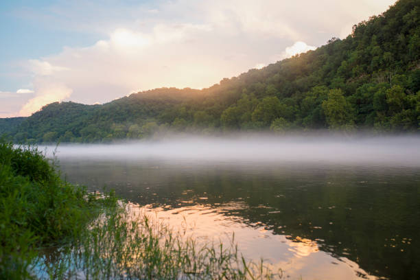
The White River served as a highway carrying supplies and crops back and forth from the frontier settlements for hundreds of years to river towns such as Memphis, Tennessee, and New Orleans, Louisiana.
White River Map
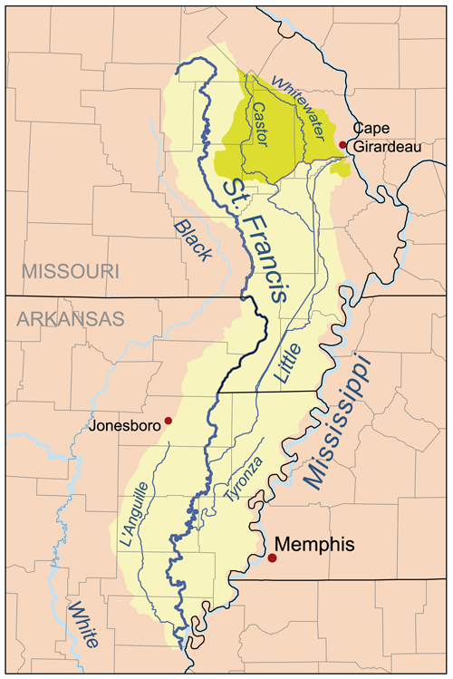
The White River is a 722-mile (1,162 km) river that flows through the U.S. states of Arkansas and Missouri. Originating in the Boston Mountains of northwest Arkansas, it arcs northwards through southern Missouri before turning back into Arkansas, flowing southeast to its mouth at the Mississippi River. The river’s Basin size is 27,765 sq mi The river’s descent in the upper course exceeds 25 feet (8 m) per mile.
White River, a river rising in the Boston Mountains, in northwestern Arkansas, U.S., and flowing northeast into southern Missouri, where it bends southeast and reenters Arkansas, continuing in a southerly direction to join the Arkansas River near its confluence with the Mississippi River, above Arkansas City.
Despite being much shorter than the Arkansas River, it carries nearly as much water normally more than 20,000 cubic feet per second and occasionally more than 100,000 cubic feet per second during periods of flooding.
The tributaries of the White River include the Cache River, Bayou des Arc, Little Red River, Black River, North Fork River, Crooked Creek, Buffalo River, Kings River, James River, and Roaring River.
In 1910, Congress authorized the construction of a hydroelectric dam on the White River by the newly formed Ozark Power and Water Company. Completed in 1913 at a cost of $2.3 million, Powersite Dam near Forsyth, Missouri confined a section of the White River to create Lake Taneycomo. The project brought electricity to a rural area of the Ozark Mountains south of Springfield, Missouri with rural electrification programs in the 1940s expanding service to the surrounding region.
White River Missouri
The White River is a 722-mile (1,162 km) river that flows through the U.S. states of Arkansas and Missouri. Originating in the Boston Mountains of northwest Arkansas, it arcs northwards through southern Missouri before turning back into Arkansas, flowing southeast to its mouth at the Mississippi River.
Through the Boston Mountains and the Ozark Plateau of southern Missouri, the White River is deeply entrenched in narrow gorges; much of its middle course is a valley more than 500 feet (150 m) deep.
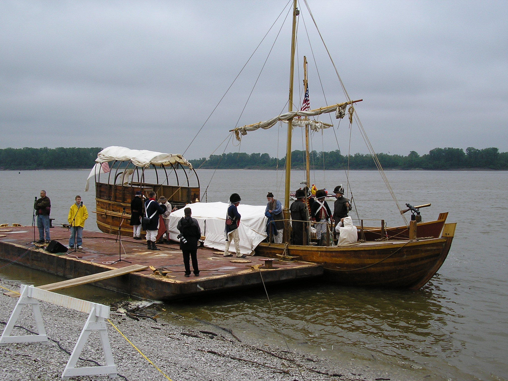
Keelboats were an early mode of transportation for Arkansas’s early settlers. Above Newport, sharp bends, rapids, and low water levels along the river during the summer months as well as the additional manpower required to move keelboats upriver against the current generally allowed travel only downriver.
A keelboat is a riverine cargo-capable working boat, or a small- to mid-sized recreational sailing yacht. The boats in the first category have shallow structural keels and are nearly flat-bottomed and often used leeboards if forced into open water, while modern recreational keelboats have prominent fixed fin keels and considerable draft.
The river served as a roadway carrying living supplies and crops up and down the river from the small frontier settlements to river towns such as Memphis, Tennessee, and New Orleans, Louisiana. Steamboat travel on the Upper White River began in 1831, and towns along the Upper White River in Arkansas and Missouri continued to dredge and clear the river for steamboat traffic until at least the early twentieth century. It wasn’t until after the Civil War, that steamboats were gradually replaced by railroads.
These days many people come here to enjoy exploring the Boston Mountains that flow through, a favored area for hiking and camping. In the Ozarks, the area offers four unique species of trout in the river making it a popular fishing destination.
Bull Shoals Dam Fishing
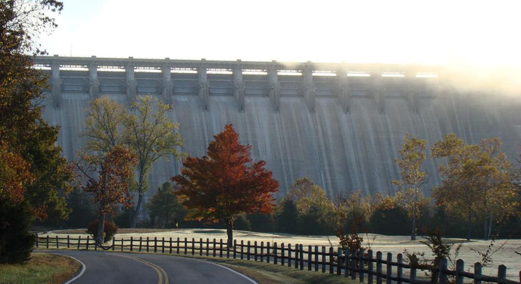
The Bull Shoals Dam the 5th largest concrete dam in the United States project began in 1947 and was not completed until 1951 due to the delay of WWII with a total taxpayer cost of 76.4 million dollars. The Bull Shoals Dam was dedicated by President Harry S. Truman on July 2. 1952. At that time, it was the fifth-largest structure of that type in the U.S. and the largest in Arkansas.
The procedure used to attain the materials for the dam was nationally recognized as well. To gather the 2.1 million cubic yards of concrete needed, the dam builders built the second longest continuous conveyor belt in the world from Lee’s Mountain Quarry to the dam site seven and one-half miles away.
The Bull Shoals Dam has 8 generators that can generate 10 million gallons of water per minute. It spans 2,256 feet in length and is 220 feet wide at the base. It rises 263 feet above the river bed. The U.S. Army Corps of Engineers operates and maintains the hydroelectric dam. About 800,000 megawatt hours of power are sold annually.
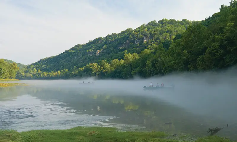
Bull Shoals Dam creates the Lake and the world-famous trout fishery, over 1000 miles of coastline. The White River continues on and flows southward from it to Missouri. Locally, the Bull Shoals Lake and Norfork Lake area is known as the Twin Lakes. This whole river area is a mecca for anglers and hunters. Bass, striped bass, crappie, and walleye fishing are year-round on the lakes. Rainbow, cutthroat, and brown trout are also abundant year-round in the cool 48-52 degree waters of the White River
Where is the Philadelphia Schuylkill River
The Philadelphia Schuylkill River begins in Tuscarora & Minersville Schuylkill County PA. meeting in southern Schuylkill County the river then flows southeast for 137 mi. through Schuylkill, Berks, Montgomery, Chester, & Philadelphia Counties in PA draining into the Delaware River at Philadelphia. …………………………………………….. read
White River Arkansas
Thousands of years before European contact, various Native American groups lived along the White River. Large agricultural towns of the mound-building Mississippian culture were present along the lower White until at least the expedition of Hernando de Soto in 1541–1542.
The first major documented exploration of the White River took place in 1819 when Henry Rowe Schoolcraft and Levi Pettibone traversed the White River from Missouri into Arkansas. Their expedition was intended to establish the source of the Mississippi River and clear up boundary disputes between the United States and British Canada.
The headwaters begin with the White River in the Boston Mountains of northwest Arkansas, in the Ozark in the St. Francis National Forest southeast of Fayetteville. The river flows northwards from its source to loop through southwest Missouri before heading southeast through Arkansas to its mouth of the Mississippi River.
The cold waters of the White River in Arkansas are known all over the world for their Rainbow and Brown Trout fishing. On the shores of the White River in northern Arkansas is the man-made Army Corps of Engineers’ Bull Shoals Lake.
Four major dams in Arkansas and one in Missouri, all constructed by the 1960s along the upper river and its tributaries, create manmade lakes and generate hydroelectric power for the region. Numerous state parks and wildlife reserves are associated with these areas. Some of these lakes include Beaver Lake, Table Rock Lake (in Missouri), Bull Shoals Lake, Norfork Lake, and Greers Ferry Lake
The use of the lower White has been more intensely agricultural and commercial than the upper White. As rice cultivation in eastern Arkansas has grown, it has steadily depleted the shallow water aquifer of Arkansas’s Grand Prairie
Where does the Missouri River Start and End?
The Missouri River a tributary of the Mississippi starts in Three Forks, Montana, as the confluence of 3 major rivers, Madison, Jefferson & Gallatin & ends in St. Louis, Missouri. Crossing South Dakota, North Dakota, Nebraska, Iowa, Colorado, and Kansas, & at 2,540 mi. is the longest river in the US. …………………………………………………………….. Read more
![]()
References:
Encyclopedia of Arkansas-White River
Bull Shoals Arkansas- Welcome to Bull Shoals
