
Everyone’s heard this rule in nature that Water will always seek the path of least resistance. It will go around or under rather than up and over whenever possible. What Determines River Flow Direction in North America?
Topography: Elevation/slope guide river flow
Watershed Boundaries: Define flow direction
Plate Tectonics: Influence geological features
Glacial History: Shape river
Human Alterations: dams/diversions
Climate Patterns: Rainfall/snowmelt
Prevailing Winds: alter river direction
Geological Features: alter flow
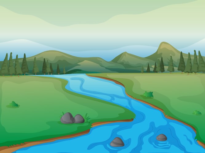
When water in nature is confronted with a mountain or even a small ridge, the river will turn and flow parallel to the blocking feature unless or until it is able to erode a path across it. The composition of the terrain determines whether or not this is possible. No two rivers are exactly alike. Yet all rivers have certain features in common and go through similar stages as they age.
Introduction:
The direction of river flows in North America is a dynamic interplay of various natural and human-induced factors. Shaped by the continent’s diverse topography, rivers follow the path of least resistance from higher elevations to lower ones. Geological features such as mountain ranges and watershed boundaries delineate the flow directions of rivers across the continent. Additionally, past glacial activity and present-day climate patterns contribute to the direction and volume of river flows. Human alterations, including dam construction and water diversions, further influence the course of rivers, shaping the landscape and impacting ecosystems along their paths.
Understanding River Flow Direction in North America
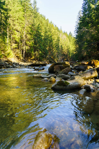
Water in nature never flows very far in a straight line. If you look at a map, you see that rivers, creeks, and streams twist and turn on their way seaward, even where there are no obstacles in their path. This twisting and turning is called meandering and develops not only in response to large obstacles, but also in response to very subtle differences in terrain, even to the the ease of flow over one grain of sand versus another
In the vast and diverse tapestry of North America’s natural environments, river flows etch patterns across the continent that have both baffled and enlightened those observing the pathways of water. It’s a land where rivers flow in serpentine routes, governed by a variety of natural factors, with some snaking to the north and others to the south.
At the heart of understanding river flow direction in North America is the undeniable truth that gravity governs the journey of every droplet. The force ensures that rivers flow from higher elevations to lower ones, with the river’s flow responding dynamically to the topography it encounters.
The continental divide separate one drainage basin from another, acting as continental crests from which water will flow toward distinct oceans. Take, for instance, the Great Continental Divide, which influences major rivers to journey either to the Atlantic or the Pacific. Rain falling on the western slopes will send rivers flowing toward the Pacific, whereas precipitation on the eastern slopes nudges rivers south or even north towards the Atlantic.
In the complex hydrological network of North America, a river basin can cradle rivers that diverge in opposite directions. Gravity does not favor north or south; it impartially tugs water downhill, irrespective of compass direction.
This means that despite how counterintuitive it may seem, numerous rivers flow northward, as is the case with the famed Nile or closer to home, North America’s own Red River. Conversely, rivers flow south when seeking the path of least resistance toward a larger water body, like the Mississippi River’s pursuit of the Gulf of Mexico.
Conclusively, when we consider the question of why rivers flow in their chosen compass course, we’re confronted with a mesh of interlaced elements. It’s the landscape’s contours, gravity relentless pull, and the imperceptible shifts of a river basin that ultimately nudge these meandering waterways to carve their unique routes.
From the monumental force of gravity to the subtle guidance of the continental divides, these are the invisible hands that guide the rivers of North America to dance either northward or southward, revealing the inherent directionality in a river’s flow that has so captivated human curiosity.
Exploring How Flow Divides Impact River Direction
When it comes to understanding the nuances of how rivers carve their paths across the continent, one can’t overlook the pivotal role of flow divides. These natural high points on the landscape function as invisible parting lines that separate one drainage basin from another. It’s these divides that play a crucial role in determining whether river flows will journey to the balmy coasts of the south or meander to the crisp northern stretches. Intriguingly, in North America, rivers are not biased in their directional flow; some rivers flowing north while others feel the pull to flow south.
A river basin is essentially a collection zone of precipitation, where every drop of water is destined to converge into a single channel, the river itself. The topographical nuances of these basins influence not only the existence of rivers but also the course they will forge, namely, whether they will opt to flow north or south.
Rivers flowing north, such as the notable Red River in the United States, confound those who assume water always heads towards the equator. Instead, they demonstrate that gravity’s call is heedless of compass directions; it favors the path of least resistance carved out by ancient ice, plate tectonics, and ongoing erosion.
How Flow Divides Impact River Direction is Based On:
- Geological Features: Flow divides are often influenced by geological structures such as mountain ranges, plateaus, and ridges, which act as natural barriers directing the flow of rivers.
- Watershed Boundaries: Flow divides mark the boundaries between different river basins or watersheds, determining whether a river flows towards the Atlantic, Pacific, or Arctic Ocean.
- Topographical Factors: Variances in elevation along flow divides play a crucial role in determining the direction of river flow, with water naturally flowing downhill along the steepest gradient.
- Human Interventions: In some cases, human activities such as canal construction or water diversion projects can alter flow divides, redirecting water away from its natural course.
- Climate Influences: Flow divides can also be influenced by climate factors such as rainfall patterns and snowmelt, which determine the amount of water available to feed rivers originating from different sides of the divide.
- Historical Factors: Past geological events, such as glacial movements during the Ice Age, may have created or modified flow divides, shaping the direction of river flow over time.
- Ecological Impacts: Changes in river direction resulting from flow divides can have significant ecological consequences, affecting habitats, biodiversity, and the availability of water resources for various species.
- Engineering Considerations: Engineers and hydrologists often consider flow divides when designing infrastructure projects such as bridges, dams, and flood control measures, as they can influence the distribution of water and potential flood risks in an area.
A river basin is essentially a collection zone of precipitation, where every drop of water is destined to converge into a single channel, the river itself. The topographical nuances of these basins influence not only the existence of rivers but also the course they will forge, namely, whether they will opt to flow north or south.
Rivers flowing north, such as the notable Red River in the United States, confound those who assume water always heads towards the equator. Instead, they demonstrate that gravity’s call is heedless of compass directions; it favors the path of least resistance carved out by ancient ice, plate tectonics, and ongoing erosion.
Why Some Rivers Flow North in North America
While it’s a common misconception that rivers flow only southward, numerous rivers throughout North America defy this notion as they gracefully carve their paths to the north. What exactly dictates the directional flow of these water bodies?

The simple answer lies in the unyielding pull of gravity governs. Each drop of water in a river’s flow earnestly seeks the route of least resistance and the lowest elevation, making their journey’s direction a matter of topographical nuances rather than cardinal rules.
Rivers, like the stalwart Red River in the United States, commence their journey at headwaters situated at higher elevations and will flow north if such a gradient leads them to northern basins.
The river flows north scenario plays out beautifully with the notable Nile and the enigmatic Saskatchewan River, contradicting the assumption that the flow direction is inherently southward.
Geography dictates that a river’s flow isn’t predetermined by its location in the Northern Hemisphere but rather by where the journey begins and the path of least resistance available. In North America, the cradle of a river doesn’t necessarily orient itself toward the equator; headwaters may originate in southern highlands, provoking the rivers flow toward the colder embrace of the north, as gravity governs the water’s relentless descent.
One can’t discuss the directional flow of rivers without delving into the dynamics of flow divides—imaginary lines that snake across the continent, defining which way rivers will direct their course. These divides can reroute a river’s flow to the north, despite the northern position it occupies on the globe. Rivers flow in North America is a testament to the autonomous nature of water, refusing to be boxed into latitudinal stereotypes. The idea that a river flows north is a poetic reminder that even within the rigid laws of physics, there exists a dance of unpredictability.
Determined by every dip and swell of the Earth’s surface, the directional flow of rivers is a geographic marvel. As we ponder the journey of rivers in North America, their northern or southern course is a call to appreciate the complex underpinnings that define our natural world. From guiding adventurers heading north to nurturing ecosystems along their banks, rivers affirm that their course is not a thing of chance but a result of the articulated whisper of gravity—they travel not merely northward, but towards destiny.
The Science Behind River Flow Patterns and Direction
When one conjures up the image of a mighty flowing river, it’s often presumed that its waters run in a southerly direction; however, in North America, the reality of river flows isn’t bound by a compass.
A river’s flow, whether meandering north, winding south, or even tracing east or west, is chiefly dictated by the relentless pull of gravity governs. Rivers flow towards the path of least resistance, seeking the quickest route downhill, which determines their eventual flow pattern. Contrary to common thought, river flows do not innately prefer any one direction—north, south, east, or west are equally possible.
Major rivers like the fabled Mississippi or the robust St. Lawrence serve as quintessential examples of how gravity governs their flow direction. Although it may seem peculiar, there exist rivers that refute the southward flow tendency and proudly course northward, such as the world-renowned Nile or even North America’s own Red River.
What drives a river’s flow to defy expectation is the topography it’s birthed in; the initial slope that nudges a newborn river into its lifelong journey is responsible for the direction it takes. Flowing rivers will carve their beds through landscapes shaped by geological processes, and it is these processes, alongside gravity, that guide a river’s determined push towards its ultimate destination—a larger body of water, whether a sea or ocean, or at times, another river.
Considering the geographical diversity within North America, river flows, whether forging north or cruising south, reveal a natural tapestry where the flow pattern is an outcome of an ever-changing terrain. The force that dictates the direction may not vary, but the environmental fabric it weaves through does. Understanding the nuances of how and why rivers flow emphasizes the ingenuity of Earth’s natural processes.
Rivers flow north when they’re north of the continental divide and gravity dictates that the drop in elevation leads them in that very direction. Similarly, rivers flow south should the gradient beckon them in that direction. The compelling dynamics of a flowing river’s path, unaffected by the magnetic poles or mythical pull to the equator, speak to the elegance of physics that unfolds across the vast landscapes of North America, rendering the continent a splendid mosaic of flowing waters that defy direction in favor of the simplest principle: gravity governs, serenely indifferent to our expectations.
Navigating the Rivers of North America and Their Flows
Navigating the rivers of North America requires an understanding of their diverse flow patterns and directions. From the eastward flow of the Mississippi River system to the westward flow of rivers descending from the Rocky Mountains, each river basin presents unique challenges and opportunities for navigation. Factors such as topography, watershed boundaries, and human interventions shape the course and direction of these vital waterways.
Embarking on an exploration of the major rivers in North America presents an opportunity to unravel the mysteries of river flows and their myriad directions. The vast network of flowing rivers across this grand continent tells a story of geographical nuance and climatic forces.
It’s a world where rivers defy intuition by not always flowing south to join the warmer currents of South America, but instead, some choose the path less traveled – meandering north. The river’s flow is determined by a complex interplay of topography, gravity, and precipitation patterns, crafting a natural course that sometimes surprises the casual observer.
When navigating the flow direction of these impressive watercourses, one must consider the subtleties that influence their journey. It isn’t merely about the river’s birthplace; rather, it’s about the landscape through which it carves its path. The Coriolis effect, often noted as a player in these dynamics, is less pronounced than one might assume; instead, it’s the contours of the land and the relentless pull of gravity that predominantly dictate whether a river flows south or decides on a northward trajectory.
Understanding river flow direction in North America is key to grasping the broader hydrological processes at work. Rivers, like the celebrated Mississippi, carve their way through the continent, predominantly flow south, contributing to lush landscapes and thriving ecosystems. However, take a river such as the Red River in the U.S. or Saskatchewan in Canada, and you’ll find clarity in the conundrum of flows south versus northern flows. The former’s southward journey is as expected as the latter’s northern flow is startling. The reasons behind these directional choices become evident through a deep dive into the geological history and current shapes of the land.
The exploration of how flow divides impact river direction or why the Snake River can calmly defy convention and journey north is not just a matter of scientific inquiry but also a boon for those who seek to navigate these waterways. Whether for transport, trade, or the pure joy of pilgrimage down a flowing river, understanding the currents, channels, and underlying reasons for their directed flow enhances the experience of every traveler.
Moreover, the science behind river flow patterns and direction isn’t just academic; it shapes the lives of millions who live along these riverbanks. For those nestled by the banks of rivers flowing north or those situated along southern-flowing watercourses, the direction of flow is a blueprint for commerce, culture, and community. So, whether it’s the mammoth Hudson or the winding Willamette, the rivers of North America hold secrets and stories that are ripe for discovery.
Conclusion:
In conclusion, the rivers of North America exhibit diverse flow patterns influenced by a myriad of natural and human-induced factors. From the towering peaks of the Rocky Mountains to the sprawling river deltas along the Atlantic and Pacific coasts, these waterways shape the landscape and sustain ecosystems across the continent. Understanding the complex interplay of topography, geology, climate, and human interventions is essential for effectively managing and navigating these vital lifelines. As stewards of these precious resources, it is imperative to balance our needs with the preservation of these natural wonders for future generations.
![]()
References:
National Geographic-Understanding Rivers
FAQ’s
What factors determine the direction of river flows in North America? The direction of river flows in North America is primarily determined by topography, watershed boundaries, geological features, glacial history, human alterations, climate patterns, and prevailing winds. These factors collectively influence the natural course of rivers across the continent.
How do flow divides impact river direction? Flow divides, often influenced by geological features and elevation changes, mark the boundaries between different river basins or watersheds. They determine whether a river flows towards the Atlantic, Pacific, or Arctic Ocean, playing a crucial role in shaping the direction of river flow.
What are some human interventions that affect river flows in North America? Human interventions such as dam construction, canal building, water diversions, and land use changes can significantly alter the natural flow patterns of rivers. These interventions can redirect water away from its original course, impacting ecosystems and water availability in different regions.
How does climate influence river flows? Climate factors such as rainfall patterns, snowmelt, and temperature variations directly affect the volume and direction of river flows. Changes in precipitation levels or melting rates can lead to fluctuations in river flow, influencing water availability and ecological conditions along river corridors.
Why is understanding river flow important for navigation? Understanding river flow patterns and directions is crucial for safe and efficient navigation along waterways. Navigators need to account for factors such as current strength, flow direction, and potential obstacles to navigate rivers effectively and avoid hazards.
