The 2024 Atlantic hurricane season is expected to remain highly active. NOAA predicts (85%) chance of 14-21 named storms, with 6-11 becoming hurricanes, and 2-5 reaching major hurricane status. Favorable atmospheric and oceanic conditions, including El Niño, continue to fuel storm development.
Introduction:
2024 Atlantic Hurricane Season: NOAA Predicts Above-Normal Hurricane Activity
The 2024 Atlantic hurricane season is projected to be especially active, with NOAA predicting a higher-than-normal level of hurricane activity. This forecast is influenced by several factors, including warmer-than-usual sea surface temperatures in the Atlantic and a weaker El Niño than previously expected.
These conditions are favorable for the formation and intensification of storms. NOAA anticipates between 14 and 21 named storms, with 6 to 11 of them likely to develop into hurricanes, and 2 to 5 of those possibly reaching major hurricane strength. Coastal communities are encouraged to stay prepared, as the increased activity heightens the risk of significant impacts.
Understanding the 2024 Atlantic Hurricane Season
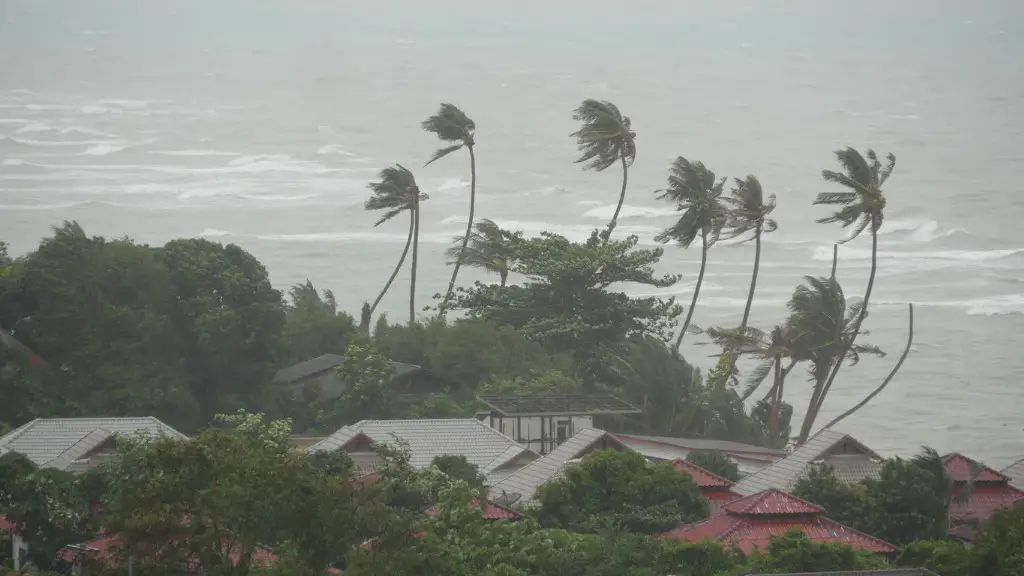
Year after year, coastal folks like us keep an eye on the Atlantic hurricane season, and 2024 is no exception. According to NOAA, this year’s going to be a doozy. The 2024 Atlantic hurricane season stretches from June through November, and forecasters are predicting above-normal activities. With their solid outlook driven by meticulous data analysis and weather patterns, seasoned experts and even us old salts whose share of storms has battered, find this heads-up invaluable. 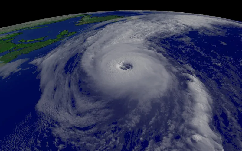
As a fisherman living on the Florida coast, the hurricane season isn’t just about storms or rain; it’s a real-life game of high stakes. Whether hauling in net lines or navigating choppy waters, keeping abreast of the NOAA forecasts is crucial.
The pronouncement for 2024 hints at the kind of year where vigilance turns disaster into survival. With a climate that’s become less predictable, acknowledging the NOAA evaluators’ insights is crucial to continuing our livelihoods. They’ve parsed decades of data—from named storms to nascent tropical depressions—to arm maritime communities with much-needed emergency preparedness tactics.
Considering that July and August tend to be the busiest months in the hurricane season, businesses along the coast brace themselves for the potential onslaught.
With NOAA’s prediction of increased storm numbers, understanding how the waters behave during these periods is imperative. Sometimes, the swells that kick up during weather alarms can make or break the catch of the season. Here in Florida, we’ve got our eyes peeled on approaching tropical storms like Beryl, knowing they can turn a good day at sea into a hasty retreat to port.
The hull is scrubbed and nets repaired, but if the 2024 Atlantic hurricane season turns wicked, knowing when to dock could be the wiser call. The sea doesn’t barter—it’s a take-it-or-leave-it mistress. If NOAA’s forecasts strike a chord of caution, the wisest action sometimes is to heed their advisories. While recovery from major storms can be sluggish, support networks and systems in place make sailing through the disaster more bearable. Support from community organizations and emergency agencies helps fellow fishermen rebuild docks and boats, ensuring our lifeblood—fishing—continues.
As part of preparing for this season, some of us set up support systems at home too. With more storms projected by NOAA over recent years, hurricane insurance, community ties, and emergency plans have become routine armor. Participation in workshops helps coastal communities weld together recovery plans, ensuring when a named hurricane, like Beryl, calls, we can welcome her wrath with courage and caution.
NOAA, the venerated weather guides, project weather patterns with commendable precision. By deciphering climatic forecasts and oceanic conditions, forecasters piece together a data tapestry from which patterns and predictions emerge. Their commitment to science and pinpoint accuracy supports our coastal lives. As 2024 unfolds, staying informed through email alerts or other communication means keeps us one step ahead. So, when the seas churn and the sky darkens during the Atlantic hurricane season, we’re prepared.
So fellow fishers and residents of these wind-battered shores know that 2024’s hurricane season calls for strategic action and meticulous preparedness. With the NOAA outlook in mind—armed with our weathered experience and the community’s robust support—we’re ready to face whatever the Atlantic hurricane season throws our way. Stay tenacious, stay informed, and let’s make it through another adventurous year at sea.
Factors that could influence this year’s forecast
The Atlantic Ocean basin is expected to be remarkably active due to several factors:
- Warmer-than-average sea surface temperatures in the tropical Atlantic Ocean and Caribbean Sea.
- Reduced vertical wind shear.
- Weaker tropical Atlantic trade winds.
- An enhanced West African monsoon.
These conditions are expected to continue into the fall. Of note, the dry Saharan air that prevented tropical storm development during portions of the middle of the summer is expected to subside in August.
Atlantic Conditions and Tropical Storm Influences
When you’re out on the open waters, the strength of the wind is like a dance partner you can’t ignore. And in the Atlantic, the 2024 hurricane season promises to be quite the performance. The National Oceanic and Atmospheric Administration (NOAA) has given us a heads-up, telling us to expect more named storms and tropical activities, than in an average year.
These Atlantic Conditions and Tropical Storm Influences aren’t just rumors; they’re solid forecasts shaped by persistent atmospheric patterns. The area stretching from the Gulf of Mexico to Barbados becomes a battleground for these swirling winds, the kind of region that tests any fisherman’s mettle.

Each year, the stories of tropical cyclones and hurricanes crossing the Atlantic become more and more familiar. But, this time, the forecasting models are painting a picture of above-normal activity.
It’s not just about numbers; it’s about understanding how these wind patterns and oceanic conditions influence the named storms that trouble the coastlines. A persistent high-pressure system, for example, can create perfect spawning grounds for cyclones to circulate. They gather strength over the warm tropical waters, fueled by heat and humidity, leading to powerful storm surges that any coast would worry over.
Understanding the Atlantic Conditions and Tropical Storm Influences is like piecing together a complex jigsaw. Imagine the Atlantic Basin as a massive chessboard, where wind patterns, ocean temperatures, and atmospheric conditions make every move unpredictable.
The influence of tropical storms can particularly issue challenges for those who face the open sea. From Mexico to Idaho, even far inland areas can feel the ripples of these hurricanes, mainly due to tornadoes spawned from their powerful winds. For us fishermen, each trip becomes a saga where formal and informal stories about past cyclones are shared and respected.
The area around Barbados has often been a barometer for the intensity of these Atlantic hurricane activities. When a tropical cyclone is named, it’s not just a news headline; it’s an alert for those tracking fish migrations or securing their vessels.
The storm surge associated with these hurricanes can reshape the coastlines, eroding land and altering habitats where business as usual becomes disrupted. Articles about past incidents illustrate how persistent winds and swirling tropical cyclones have brought about significant damage and transformation along the Atlantic corridor.
Among the examples of powerful Atlantic hurricanes, the lessons learned go beyond mere survival tactics. The interactions of hurricanes with the coast highlight how seasonal patterns, like those forecasted for 2024, influence environmental and human systems persistently. Whether it’s the rhythm of the winds or the ominous cloud formations, understanding the foundational conditions of these Atlantic hurricane stories gives business owners, coastal dwellers, and seafarers something substantial to work with. The persistent focus of meteorologists on these tropical systems issues a reassuring guidepost in an ever-challenging seascape.
It may seem odd to think about a tropical cyclone’s influence reaching far-off places like Idaho, but national reports have shown that nowhere is quite safe from nature’s dance. The understanding of how these systems circulate is crucial, particularly when persistent patterns show an increase in the storm surge and wind speeds that hurricanes bring. It’s the Atlantic’s personality, ever-changing yet stubbornly familiar, drawing comparisons even to powerful tornadoes in their ferocity, that captures us sailors’ hearts and demands our constant vigilance.
As we face the upcoming 2024 Atlantic hurricane season, the wise know it’s not just about surviving the storm but thriving in its wake. Tracking the conditions and understanding the influences at play, each named storm becomes another character in the ongoing saga of the Atlantic.
For those who navigate its waters and reside along its coasts, the Atlantic’s tropical tales offer a complex dance, weaving business, survival, and a deep respect for the very forces that shape its destiny. So, hold tight, keep your sails ready, and remember that in the world of hurricanes and tropical storms, forewarned is forearmed.
Key Information on Expected Hurricanes and Storms
In the world of casting lines and finding the perfect catch, the predictions for the 2024 Atlantic hurricane season got us sailors steering cautiously. NOAA’s forecasts whisper warnings of an above-normal hurricane performance, and this means there’s a lot for us to keep our eyes peeled on. Hurricanes and other ferocious storms carry their own set of dangers, including relentless winds and potential flooding—real category changers for anyone caught unprepared on the open waters. 
These monstrous weather phenomena, known as hurricanes or cyclones depending on their birthplaces, tend to make seafarers and coastal dwellers quite uneasy. With the Atlantic brewing more hurricanes than shells on a seashore, it’s crucial to grasp the nitty-gritty details NOAA’s latest data has to offer.
They’re releasing information at a clip, making papers and websites hum, and every claim they make becomes top news. Dubbed with the ominous nickname of a hurricane, these storms form with an intensity that can take your breath away.
They don’t just ruin a day at sea; they make urbanism tremble with fears of urban flooding and exacerbate the harsh consequences of famine—a specter that haunts regions like Jamaica when crops take a hit.
Every seasoned fisherman knows that when hurricanes ramp up, you better shape your sails or find yourself below deck. The Atlantic is rarely still, a fact we old salts have come to terms with.
But when the sinister Doppler images show those wind patterns swirling like an angry school of fish, that’s when you know it’s not business as usual. NOAA’s figures already got some of us simultaneously eyeing the docks and the skies hoping for a split in the tempestuous winds.
A fundamental thing to appreciate is how these storms split and dovetail with nearby cyclones. Historical data shows this dance raises the storm tally higher and higher, a whirlpool of storms spinning across the Atlantic expanse.
Headlines scream about toppling winds fierce enough to turn even the beefiest trawler topsy-turvy. As the wind rises in the category, the skipper’s dreams are called into question. Fishermen fundamentally have to navigate the winds, not just the ocean. Hurricanes and cyclones are made of winds when they reach speeds that warrant a name. A hurricane’s name isn’t just inked on paper—it’s a warning echoing across maritime channels and docks full of boats. From low-category storms to devastating cyclones, everything simultaneously tells the story of the brute that hurricanes become.
Crucially—if you’re claiming the salty sea as your dominion—watch out for the clever traps these storms lay. The very winds that call the gale don’t just gust and go; they shift and twist like a fish on the line. Wind trajectories, split by unyielding geographies and overcast by foreboding cloud heaps, are influenced by elusive atmospheric splits that result in meteorologists scratching their heads.
As news breaks out in various releases, and updates about wind patterns get to the masses, figuring out how these storms affect topography becomes invaluable. Amidst all this, we collectively stick close to pieces of news and Doppler technology, whose whispers we can no longer ignore if we wish to dock safe and sound.
As we bravely face them head-on, we live with the gripping reality that each hurricane brings news of potential devastation, flooding urban stories of loss and rebuilding. For those of us bound in a circle of reliance with the sea, weather insights, and split-second decision-making are the lines that keep us afloat. This Atlantic hurricane season may be full of unyielding challenges, split between the forces of nature and the resilience of humanity. By head-changed circumstances and anchored strength, may ships find their way through unharmed waters, returning safely to tell tales of storms passed and gales endured.
Conclusion:
In conclusion, the 2024 Atlantic hurricane season is poised to be more active than usual, driven by favorable atmospheric and oceanic conditions. With the possibility of numerous named storms, hurricanes, and major hurricanes, NOAA’s prediction underscores the importance of preparedness for coastal regions. As climate variability continues to influence weather patterns, communities in hurricane-prone areas should stay informed and take proactive measures to mitigate risks during this heightened season.
![]()
References:
NOAA- Highly active hurricane season likely to continue in the Atlantic
FAQ’s
1. What is the 2024 Atlantic hurricane season forecast?
NOAA predicts above-normal hurricane activity for the 2024 Atlantic season, with 14 to 21 named storms, 6 to 11 hurricanes, and 2 to 5 major hurricanes.
2. Why is the 2024 hurricane season expected to be more active?
The forecast is driven by warmer-than-usual Atlantic sea surface temperatures and a weaker El Niño, both of which encourage storm formation and intensity.
3. When does the 2024 Atlantic hurricane season start and end?
The official Atlantic hurricane season runs from June 1 to November 30, 2024.
4. What is the difference between a named storm and a hurricane?
A named storm is a tropical system with sustained winds of at least 39 mph, while a hurricane has sustained winds of 74 mph or higher.
5. What areas are most at risk during an active hurricane season?
Coastal areas along the Atlantic and Gulf of Mexico, as well as islands in the Caribbean, are at higher risk during an active hurricane season.
6. How can I prepare for the 2024 hurricane season?
Stay informed about forecasts, have an emergency plan, secure your home, and keep supplies such as food, water, and medications ready in case of evacuation or power outages.
7. What is a major hurricane?
A major hurricane is classified as a Category 3 or higher, with sustained winds of 111 mph or greater.
8. How does El Niño affect hurricane activity?
El Niño typically suppresses hurricane activity in the Atlantic by increasing wind shear, but in 2024, it is expected to be weaker, contributing to a more active season.
9. What role do sea surface temperatures play in hurricane formation?
Warmer sea surface temperatures provide more energy for storm development, leading to stronger and more frequent hurricanes.
10. What should I do if a hurricane is approaching?
Follow local authorities’ instructions, secure your property, and evacuate if advised. Stay tuned to weather updates and have a hurricane preparedness kit ready.