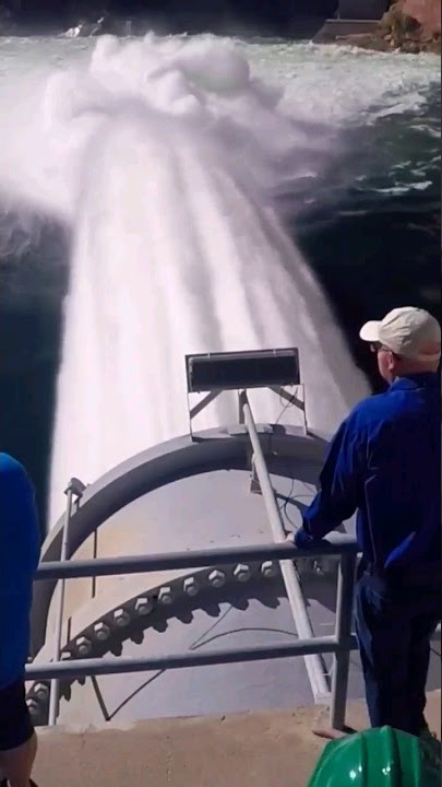
It’s been a very wet year in the Southwest for the biggest reservoir in the U.S. Leveling off after steady increases since early April, Lake Mead appears to have reached its peak for the year — more than 22 feet above last year. Who Monitors Lake Mead’s Water Levels?
Lake Mead’s water levels are monitored by the U.S. Bureau of Reclamation, responsible for overseeing Water Resource Management, including the monitoring and regulation of water levels at Lake Meade, collection, and dissemination of accurate up-to-date information regarding the lake’s water levels.
The end result: Lake Mead is now 34% full at the end of the 2022-23 “water year,” which runs from Oct. 1 to Sept. 30 each year. Lake Powell is at time 38% full after years of drought conditions.
Introduction:
In the parched vastness of the American Southwest, Lake Mead stands as a barometer for the region’s vitality, its water levels scrutinized by a network of dedicated guardians. This article embarks on a journey to uncover the diligent stewards of this crucial reservoir, exploring the recent surge in its water levels that’s sparking whispers of hope. As we delve into the complexities of water management and the significant improvements at Lake Mead, prepare to meet the unsung monitors poised on the front lines of this liquid battlefield.
Who Monitors Lake Mead’s Water Levels
Lake Mead’s water levels are monitored by several organizations, primarily the United States Bureau of Reclamation (USBR). The USBR manages water resources in the western United States, including the Colorado River Basin, where Lake Mead is located. They track water levels, inflows, outflows, and other relevant data to manage water resources effectively.
Additionally, the National Park Service (NPS) also plays a role in monitoring Lake Mead, especially since it is located within the Lake Mead National Recreation Area. Other stakeholders such as state water agencies, local water districts, and academic institutions may also be involved in monitoring and analyzing water levels in Lake Mead.
Tracking Lake Mead Water Levels: Essential Data and News Updates
Nestled in the arid terrain, where the shimmering horizon meets the sky, Lake Mead’s water level has been a topic of crucial importance. It’s the responsibility of several entities to keep a watchful eye on the lake levels, ensuring that the data is meticulously recorded for the Colorado River system’s sustainability and the surrounding communities. Monitoring Lake Mead’s water levels isn’t just a task; it’s a pivotal exercise in ecological stewardship and an ongoing testament to the balance between human needs and nature’s offerings.
Lake Mead’s water levels are monitored by the U.S. Bureau of Reclamation. They are responsible for overseeing water resource management, including the monitoring and regulation of water levels in Lake Mead. The Bureau of Reclamation ensures the collection and dissemination of accurate and up-to-date information regarding the lake’s water levels, crucial for effective regional water management and planning.
1:00:00 PM
The level is 158.53 feet
below full pool of 1,229.00

To keep abreast of Lake Mead water levels, enthusiasts and experts alike turn to news updates. It’s where information turns into knowledge—where hours ago, an update might have indicated a concerning drop, current reports could hint at a significant improvement in the lake’s water level.
These fluctuations are normal, but with the right tools and measures in place, each variance in water levels can be managed and understood within the broader context of the lake’s health.
It’s not an overstatement to say Lake Mead is at the heart of the Colorado River system, and keeping tabs on its lake levels is a communal effort that crosses state lines and even borders.
Each piece of data is a thread in a tapestry that depicts the lake’s condition over time, providing invaluable insights to those who have kept a watchful eye over it, hour after hour.
Lake Mead, which has seen its water level rise and fall, is more than just a body of water—it’s a barometer of climate, an agent of change, and a lifeline. This is why monitoring the lake’s water levels is not taken lightly.
It’s about resilience, foresight, and the meticulous stirring of human ingenuity at work with nature. It’s about making sure that when someone searches for information on Lake Mead’s water level, they find not only data but also a story of a lake woven deeply into the fabric of an entire region.
It’s a dedicated, relentless monitoring of water levels, each update pulsing through the veins of the web, that we ensure the story of Lake Mead is not one of mere statistics, but of hope, human endeavor, and perpetual reverence for the water that sustains us all.
Exploring the Relationship Between Lake Mead’s Water Levels and Vegas Energy Needs
As the lifeblood of Las Vegas, the water and energy nexus hinges critically upon wrangling the controls of Lake Mead’s rapidly changing tides. Amidst the severe drought that has clenched the Southwest in a parched grip, the ostensibly endless desert has faced a quandary of scarcity. Tasked with the vigilant observation of Lake Mead water levels, a coalition of regional stewards, namely the Bureau of Reclamation, forges ahead to ensure an equilibrium is maintained between conservation and consumption for these important reasons:
- Water for Power Generation:
Investigate how Lake Mead’s water levels impact the generation of hydroelectric power for meeting energy needs in the Las Vegas region. - Drought Effects on Energy Supply:
Explore the correlation between drought conditions affecting Lake Mead and potential implications for energy production. - Reservoir Levels and Energy Resilience:
Examine how maintaining adequate water levels in Lake Mead contributes to energy resilience and sustainable power supply. - Climate Change and Energy Challenges:
Analyze the relationship between changing climate patterns, decreasing water levels, and the challenges posed to fulfilling Vegas’ energy demands. - Water-Intensive Cooling Systems:
Investigate how water scarcity, influenced by Lake Mead’s levels, affects cooling systems in energy infrastructure, impacting efficiency. - Policy Responses to Water-Energy Nexus:
Explore policy measures and initiatives aimed at addressing the interconnected challenges of water availability and energy needs in the Vegas region. - Innovations in Water-Efficient Energy Production:
Highlight technological advancements and innovations in energy production that consider and mitigate the impact of Lake Mead’s water levels. - Community Awareness and Conservation:
Discuss the role of public awareness and community conservation efforts in addressing the relationship between Lake Mead’s water levels and energy sustainability. - Alternative Energy Sources:
Explore the exploration of alternative energy sources in response to potential fluctuations in hydroelectric power production linked to Lake Mead’s water levels. - Collaborative Approaches for Sustainability:
Investigate collaborative efforts between water management authorities and energy stakeholders to ensure a sustainable balance between Lake Mead’s water levels and Vegas’ energy needs.

With the context of the river being the central vein that sustains the lake, the far-reaching tendrils of drought conditions have prompted water level concerns to take on a heightened sense of urgency. The water level’s variation is more than a mere statistic; it’s a critical barometer for the health of the entire Colorado River Basin—a vast ecological system that has, in recent times, seen Lake Mead’s water level dwindle alarmingly.
Onlookers from Las Vegas to the canyon’s rim have kept an anxious watch on the lake level, knowing all too well the intricate co-existence between the lake’s sustenance and Vegas’ vivacity.
Energizing Las Vegas, the turbines within Hoover Dam are a testament to human ingenuity and reliance on natural hydrological cycles. The lake’s water, once harnessed, courses through power lines to brighten the neon-lit nights of Vegas.
So when improvements in Lake Mead water levels are reported, a collective sigh of relief echoes through the energy corridors. This surge in the lake level serves as a beacon of hope that the persistent drought might relent enough to safeguard energy security for Las Vegas—a city whose fortunes rise and fall with the ebb and flow of Lake Mead.
It’s a balancing act of epic proportions: to assert control of the water demands amid the parched reality without dampening the glowing spirit of Las Vegas. The trajectory of Lake Mead water levels symbolizes not just the physical quantity of water, but also the pulsating lifeblood of an entire region.
Recognizing this, the entities who monitor Lake Mead’s water level don’t just report figures; they are the sentinels of the Southwest, guarding the fluid treasure that spells prosperity or peril. They wrestle with the relentless drought, and each uptick in water levels translates into a ceaseless current of hope for a city founded on dreams, dancing waters, and the undimmed energy of survival.
In a landscape dominated by drought, the beacons of Lake Mead, with each rise in lake level, become more than just natural phenomena; they are the harbingers of possibility, the wellspring from which Vegas draws its unending energy. The lake’s water level, minutely tracked and managed, is the fulcrum upon which the city’s fate tilts, a testament to the enduring symbiosis between Lake Mead’s waters and the rhythmic heart of Vegas itself.
The Role of Websites and Technology in Monitoring Lake Mead Levels
Websites and technology play a pivotal role in monitoring Lake Mead levels by providing real-time data accessible to the public and relevant authorities. Dedicated websites offer interactive dashboards and visualizations, allowing users to track water levels, understand historical trends, and stay informed about current conditions.

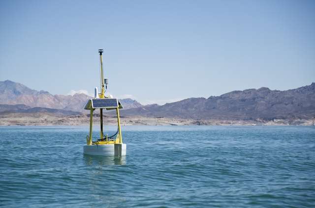
Advanced sensor technologies and remote monitoring systems contribute to accurate data collection, ensuring the reliability of information available online. Additionally, automated alerts and notifications through websites enable swift responses to significant changes in lake levels. Overall, the integration of technology enhances transparency, public awareness, and efficient decision-making in managing Lake Mead’s water resources.
In the digital era, where data is as crucial as the precious water itself, websites and emerging technological advancements play a pivotal role in chronicling the changing tides of Lake Mead’s water levels. The monitoring of this critical resource isn’t just a numbers game; it’s a constant battle to balance ecological stewardship with the throbbing pulse of human necessity.
Websites, acting as digital sentinels, offer not just snapshots but ongoing narratives of the highs and lows, the wax and wane of Lake Mead’s aquatic fortunes. As observers from afar tap in, they’re privy to the oscillating metrics that define the health of America’s largest reservoir: Lake Mead.
Imbued with the responsibility of vigilance, these websites don’t merely display dry figures; they extrapolate, predict, and warn, transforming raw data into actionable intelligence. Through such digital platforms, Lake Mead’s water level isn’t a static figure etched on a ruler; it’s a live statistic, pulsing with the potential to ripple through local economies and ecosystems. Add to this the remarkable technology beneath the surface—sensors, satellites, and automated systems—that tirelessly gathers, refines, and dispatches lake water levels with unwavering precision; technology has not just aided but redefined the metrics of monitoring.
Crucial indeed to this narrative are the repetitive keywords like ‘water’ and ‘lake’, but these aren’t just tokens of vocabulary; they’re central to understanding the dynamic nature of Lake Mead. Each ‘level’ reported is part of a larger environmental sonnet, where ‘monitoring’ is synonymous with safeguarding our future. Lake Mead’s water level mirrors the caprices of nature and the footprint of human intervention, and as such, the lake’s levels furnish a litmus test for our conservation efforts. Technology and lake-oriented websites have reimagined the act of monitoring, turning Lake Mead into a case study of how technology intersects with environmental oversight.
The lake’s water levels tell us much more than the volume of water; they serve as a narrative of our relationship with nature. As the Lake Mead water level ascends, buoyed by successful conservation strategies, it serves as a harbinger of hope, a testament to human ingenuity in the face of ecological caprice.
The conversation around Lake Mead’s water levels and the websites and technology that anchor this discussion isn’t just idle chatter; it’s a dialogue of survival, a testament to our relentless pursuit of equilibrium between human need and the sustainable custody of our water resources. At the heart of this discourse is Lake Mead, a canvas on which the strokes of natural variability and technological mastery conjure up a picture of what monitoring the reservoir of man and the environment should look like.
Deciphering Lake Mead’s Elevation Data: From Feet to Forecasting
As the guardians of ecology and economy alike fix their gaze on the water levels of Lake Mead, its significance cannot be overstressed. At the heart of water level scrutiny is the unit of ‘feet,’ a simple measurement spiraling into complex forecasts about the future of this body of water. Peeking at the elevation data of Lake Mead, we uncover an intricate tale of hydrological dynamics, where each incremental change in feet reverberates across states that depend on its waters.
Each foot climbed or descended in Lake Mead’s water level is meticulously recorded, building a narrative of natural ebbs and flows or, in recent times, an uplifting plot twist of notable improvements.
Websites brimming with real-time data allow the monitoring and forecasting of Lake Mead water level changes with a precision that was once the stuff of a water manager’s reverie. The role of websites has moved from static information to dynamic platforms equipped with forecasting tools that predict the rise and fall of these critical lake levels, using historical and current water level data to paint a picture of tomorrow’s Lake Mead.
The relationship between Lake Mead’s water levels and Vegas energy needs is akin to that of a lock and key, and it’s no secret that a healthy lake level at Lake Mead is the cornerstone of maintaining this energy-life balance. The lake’s water levels feed turbines, and each foot of water is a testament to the renewable energy that pulses through the Vegas Strip. As we excavate further into the precise data that defines Lake Mead’s water levels, we discover a forecast that holds the power to reject or validate energy strategies, while simultaneously nurturing the lake’s aquatic life.
Monitoring these water levels, one might conclude, is a task of huge proportions, yet undoubtedly essential. Lake Mead’s elevation monitoring is executed with a cooperative spirit that ensures data integrity and prompt news updates to stakeholders. It’s an act of unyielding commitment to stewardship, ensuring that every foot accounted for in Lake Mead translates into actionable strategies.
Thus, in the realm of Lake Mead water level oversight, feet become more than a measure; they morph into a barometer of health for ecosystems, a gauge for climate adaptation, and a beacon for forecasting future trends. The significant improvement in Lake Mead’s water level denotes not just a triumph throughout daunting droughts but heralds a buoyant chapter for this life-giving lake. Indeed, every foot count and forecast based on these counts could spell a sustainable future for Lake Mead and its benefactors.
Conclusion:
In conclusion, deciphering Lake Mead’s elevation data is pivotal for understanding the reservoir’s dynamic nature and ensuring effective water resource management. The use of feet as a measurement unit provides a tangible means to assess the depth and fluctuations in water levels. Historical trends offer valuable insights into the reservoir’s behavior over time, guiding current assessments.
Forecasting models leverage elevation data to anticipate future scenarios, facilitating proactive measures for sustainable water use. The impact on water infrastructure and the correlation with climate change underlines the broader implications of elevation data. Public access to real-time information through websites enhances awareness and community engagement, while collaboration with water management agencies ensures accurate data dissemination.

References:
MyWaterEarth&Sky- US Drought Monitor-Tsunami-Live Feed (DART) NOAA
Nevada Online-Lake Meade Water Level
FAQ’s


